Welcome to Altitude Vision, LLC
At Altitude Vision, LLC, we are dedicated to transforming the way construction projects are viewed and managed. Our advanced drone technology provides high-quality aerial imagery and videography that enhances project planning, monitoring, and execution. Based in Columbia SC, we serve the construction and residential industry with precision and reliability. Explore new heights with our unmatched drone photography services and discover the difference we can make for your construction and residentials ventures.
Meet our team

Tremaine Coaxum
Founder
Thirty years ago, I began my land surveying career in Beaufort, SC. Two years into my surveying career, I was placed in charge of land surveying projects small as 0.20 tenths of an acre and large as 770 acres from beginning to end. I am a FAA licensed drone pilot. Throughout my career, I've earned a certificate in Highway Design, AutoCAD, and Engineering Surveying Preparation at the Technical College of the Lowcountry.


Our Services

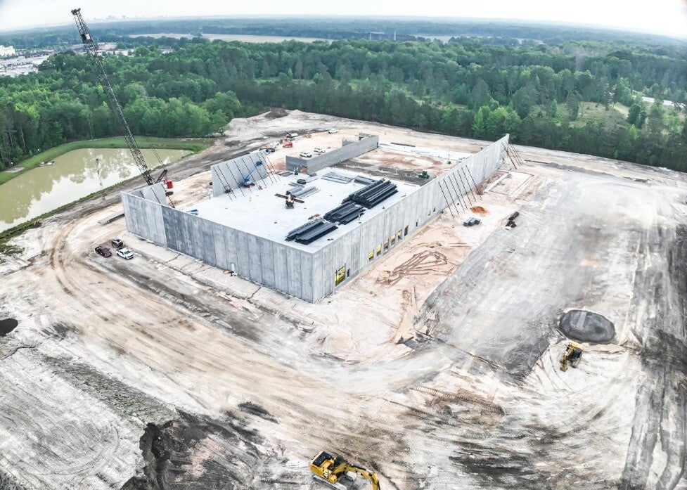
Aerial Imaging
Experience unparalleled clarity and detail with our state-of-the-art aerial imaging services. Our drones capture high-resolution images that provide clear insights into residential and construction projects, enhancing decision-making and site management. Trust Altitude Vision, LLC for precision and accuracy in every shot.

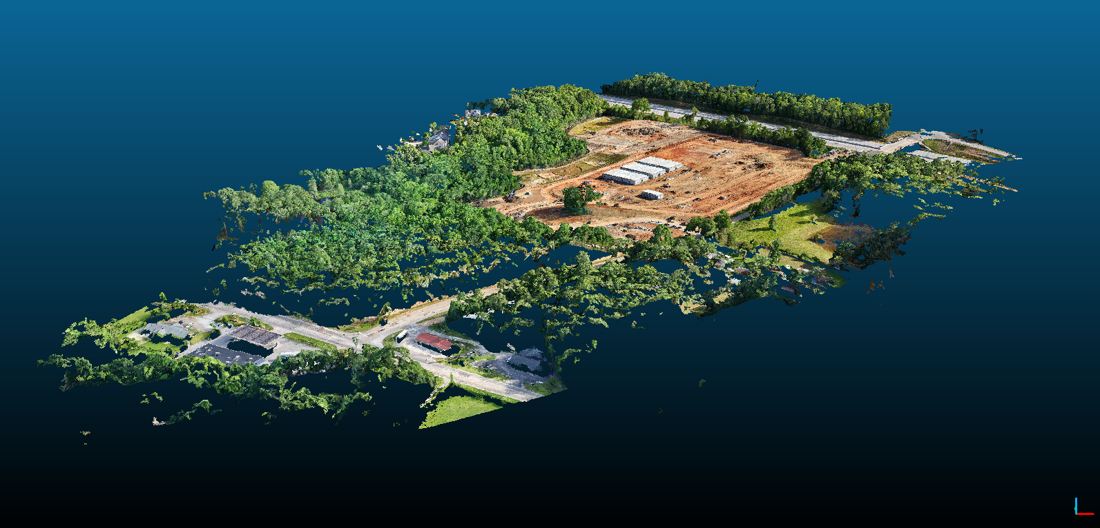
3D Modeling
With our sophisticated drone technology, we can do a lot of things. Using photogrammetry software, we can stitch the photos into one image. These services are essential for project planning and execution, enabling efficient site analysis and resource management. Disclaimer: (Our 3D models is for reference and visualize purposes only, and do not represent legal property boundaries. Any air mission for surveying purposes must be held in conjunction with a licensed surveyor.

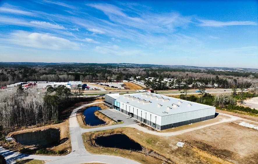
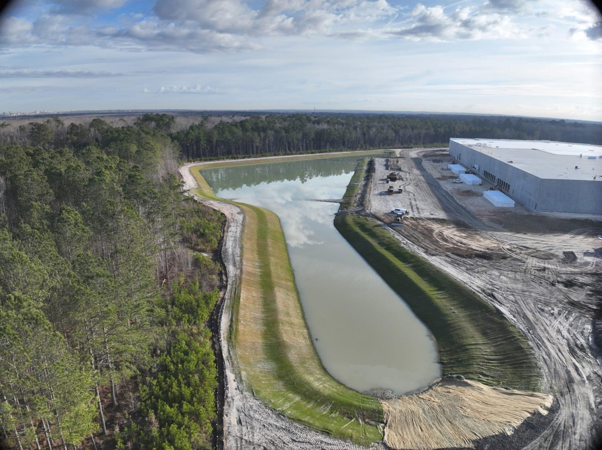
Construction Inspection
Ensure safety and quality with our construction and residential inspection services. Our drones assess project sites, identify potential issues, and provide detailed imagery. This proactive approach helps maintain safety standards and boosts project efficiency.
Cancellation Policy:
We require a minimum of 24 hours' notice to cancel or reschedule your appointment. Cancellations made within 24 hours of the scheduled time may be subject to a fee. Please email us at altitudevision2025@gmail.com to cancel or reschedule. Thank you for your understanding.
Frequently asked questions
We at Altitude Vision, LLC, transforms project management approach with our exceptional drone services. The clarity and insights provided by our aerial imagery is unparalleled.
Location & Contact Information
9600 Two Notch Rd. Suite 5
Columbia, SC 29223
(843) 592-4690
Ready to Elevate Your Project?
Discover how Altitude Vision, LLC's cutting-edge drone services can revolutionize your construction and residential projects. Contact us today to learn more and get started.